Making a mud-map
Making a simple mud-map
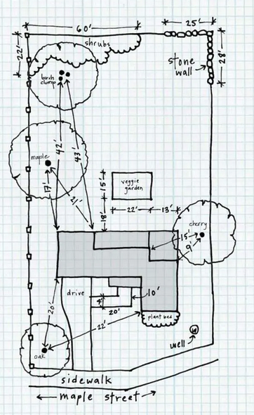
A mud map is a rough, hand-drawn sketch used to visualize property layouts, typically highlighting boundaries, existing structures (house, shed), pathways, trees, and, crucially, environmental factors like sunny/shady areas, wind direction, and slopes. It acts as a quick, often single-use, reference tool for planning.
Here is a guide to making one:
- Outline the Boundary: Sketch the general shape of your property.
- Add Permanent Structures: Draw in the house, driveway, shed, and fences.
- Map Features: Sketch large trees, garden beds, and water sources.
- Note Environmental Data: Mark North, sunny/shady spots, and windy areas.
- Draw Pathways: Sketch how you walk through the area.
You can draw this on paper, using a pencil for easy changes, or even in the dirt with a stick for a quick, collaborative sketch.